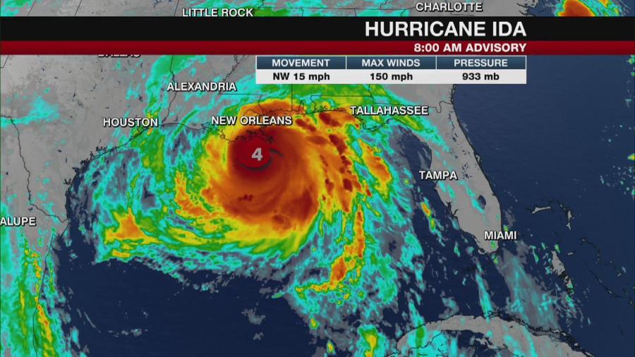
TAMPA, Fla. (WFLA) — Hurricane Ida has made landfall near Port Fourchon, Louisiana, as a category 4 hurricane, according to an advisory from the National Hurricane Center.
According to the NHC, the storm is moving northwest at 13 miles and has reached max sustained winds of 150 miles per hour.
The NHC said Ida is expected to bring a “life-threatening storm surge, potentially catastrophic wind damage, and flooding rainfall” to the northern parts of the Gulf Coast, with impacts potentially starting Sunday morning.
Rainfall amounts are expected to be between 10 to 18 inches with isolated maximum levels possibly reaching into 24 inches of rain across southeast Louisiana into southern Mississippi, according to the NHC. The water is expected to be at its deepest on the coast near or east of landfall, where larges waves are expected to join the surge.
Ida is expected move well into the inland parts of Louisiana and west Mississippi before possibly making a turn to the northeast Monday.
A Storm Surge Warning is in effect for:
- East of Rockefeller Wildlife Refuge Louisiana to the Alabama/Florida border
- Vermilion Bay, Lake Borgne, Lake Pontchartrain, Lake Maurepas, and Mobile Bay
A Hurricane Warning is in effect for:
- Intracoastal City Louisiana to the Mouth of the Pearl River
- Lake Pontchartrain, Lake Maurepas, and Metropolitan New Orleans
A Tropical Storm Warning is in effect for:
- Cameron Louisiana to west of Intracoastal City Louisiana
- Mouth of the Pearl River to the Alabama/Florida border

