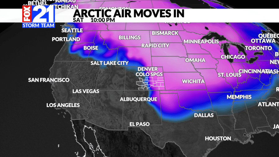
(SOUTHERN COLORADO) — The arctic front that the FOX21 Storm Team has been tracking for several days now is finally knocking on our front door. Models first started picking up on this potential arctic outbreak about 10 days ago and now that it’s nearly here, the details have become much more clear.
Hazards to look out for:
Heavy, blowing snow for the mountains
High wind for most of Southern Colorado
Dangerously cold air temperatures
Wind chills 20 to 30 degrees below zero
There are several big weather headlines to focus in on but the wind chills for most of the lower elevations may pack one of the bigger punches. This incoming cold snap is likely to last for several days.
The timing for this arctic air is from very early Saturday morning – Tuesday evening.
The wind chill warnings across the area are in effect from 2 a.m. Saturday morning until 11 a.m. Tuesday morning. The National Weather Service is warning that, “the cold wind chills could cause frostbite on exposed skin in as little as 30 minutes.”
Wind chills may very well drop 20 to 30 degrees below zero, so do your best to limit any time outdoors. It’s best to stay inside all together if possible!
Looking ahead just a bit, we may see some of our coldest temperatures ever on Sunday; we could even break some records. Highs for the Eastern Plains will generally be in the single digits and for Colorado Springs and Pueblo, it just might be enough to break a 50 year old record.
Forecasted highs this Sunday will be 4 and 6 degrees for the Springs and Pueblo respectively. If those numbers hold true, then they would be the new coldest high temperatures on record for that specific day. The old record was 10 degrees for each location back in 1972.
If you happen to live in the mountains, then this event will be more focused on snow for you. The Sawatch Range, up to our northwest, will feature several ‘waves’ of energy and multiple rounds of snowfall this weekend. Although it will still be cold, the big story shifts to heavy snowfall for the next few days that direction.
Stormcast Southern Colorado
Stormcast Southern Colorado
Continuous snowfall will move through the Central Mountains with blowing and drifting snow causing significant travel impacts. Travel is not advised in this direction at all as visibility and slick road conditions will cause big problems.
For the lower elevations, snow is still possible over the next few days, but anything that falls will likely be light, fluffy and not amount to very much.
As mentioned above, winds will also play a significant role in impacts felt across the viewing area. Wind chill, reduced visibility and drifting snow will all be likely depending on which part of the state you live in.
By Tuesday afternoon, Southern Colorado will slowly start to recover with double digit temperatures back in the forecast. That may not be saying much, but it alludes to a warmer pattern. Highs on Wednesday will be close to 50 degrees before another stretch of cold air moves in again.

