(SOUTHERN COLORADO) — A relatively weak system is moving across portions of Colorado as of Friday afternoon, March 7. The majority of this storm system is expected to stay well south of the region, however certain areas will still be impacted.
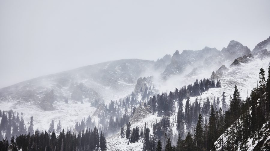
Portions of the Rocky Mountains have received a good amount of snow over the last couple of days. Weather across the higher terrain has been overall unsettled with mostly breezy conditions at the lower elevations.
As of Friday afternoon, there are several winter weather headlines to address. First are a couple of different winter storm warnings around the San Juans, Central Mountains, and Sangre de Cristos. The Central Mountains have largely seen the bulk of their snowfall; warnings and advisories will likely expire later on Friday.
The San Juans and the Sangre de Cristos, however, are anticipating some fairly extensive snowfall over the next 24 hours. Winter storm warnings and winter weather advisories will mostly be active through late Friday and early Saturday morning. In general, a foot of snow can be expected for some of our mountain tops.
With the increase in snowfall and a variety of temperatures fluctuating across the region, avalanche danger is also elevated for specific areas in the Rockies. An avalanche warning is active until Friday evening for the Central Mountains according to the National Weather Service. An avalanche watch is also in place for portions of the San Juans through much of Friday.
The storm system itself will, once again, largely miss Colorado. Southern portions of the region will receive a healthy amount of snowfall but impacts elsewhere will be rather limited due to the position of the storm.
Here’s a look at snowfall timing with the latest model guidance as of Friday afternoon. There is a small chance portions of the Pikes Peak Region may see some isolated snowfall around dinnertime but very light accumulations are expected.
Further south, much more snowfall is anticipated with heavy snow moving in just after midnight. Las Animas County and surrounding areas in particular can expect accumulating snowfall.
Thereafter, snow will begin to wrap up by late Saturday morning as the system departs the area.
As far as specific snow totals go, here is what the FOX21 Storm Team is anticipating. For Las Animas County and the surrounding areas, a solid three to nine inches of snow is possible with the higher amounts backed up against the mountains. Moderate accumulations should extend all the way east through Kim and much of Baca County.
The Pikes Peak Region, as mentioned, will mostly miss out this time around. There is the possibility of some light accumulations in and around the higher elevations but Colorado Springs itself isn’t expecting much more than a dusting.
For temperatures, overnight lows will drop into the teens and lower 20s. The mountains and mountain valleys will be quite a bit cooler with slightly warmer temperatures across the plains.
Highs on Saturday will improve a bit with 40s and 50s for much of the lower elevations. Mountains and the surrounding higher elevations may be stuck in the 30s. A more significant warm-up is on the way with temperatures near 70 in the Springs on Monday.

