(SOUTHERN COLORADO) — After a pretty nice early November weekend with seasonal temps in the 50s and 60s, there seems to be a higher likelihood of a pretty strong storm over the western United States early next week.
What the FOX21 Storm Team know
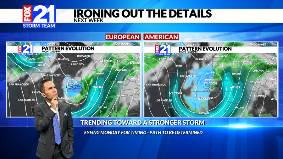
Southern Colorado is probably going to see a circulation develop within a big dip in the jet stream Sunday night into early Monday. A developing circulation means the storm is strengthening and efficiently lifting moisture moving into the storm. It looks like the mountains will get some snow regardless and east of the mountains this means good rain and snow for someone.
What we’re still working on
The path of this maturing storm is still to be determined – and is really important! If it is too far north, Southern Colorado could get a “dry-slot” to the southeast of the storm circulation and just get high fire danger and wind. If the storm is far enough south, Southern Colorado would be in the comma head of the storm and clipped with a shot of rain/snow. If the circulation is on the Colorado/New Mexico line or northern New Mexico, Colorado could get a pretty decent snowstorm.
The forecast process
There’s a good scientific reason meteorologists make forecasts every day – and through every day. As the atmosphere moves, meteorologists learn more about storm systems and how they are likely to evolve. A week out, meteorologists are looking for patterns – orientation, and strength of jet streams, how cold air is pooling, and getting ready to move.
As meteorologists identify patterns becoming more or less likely, storms are usually getting toward the west coast of the United States and meteorologists start to get weather balloons up inside the storms that allow them to start honing in on the timing and path. As meteorologists start to monitor the storm from the surface with ground weather stations and radar they get even more information and are really able to drill down on details and impacts.

