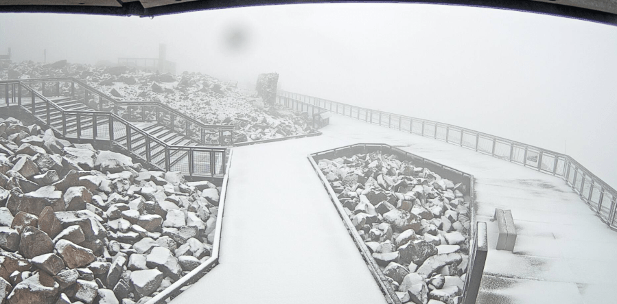
(SOUTHERN COLORADO) — A cold front that moved in overnight brought a dusting of snow to America’s Mountain on Friday, Sept. 5
Cameras on Pikes Peak captured the scene on Friday morning.
According to FOX21 Storm Team Chief Meteorologist Matt Meister, Friday’s temperatures will range between the 50s and 60s across Southern Colorado.
“We actually hit our high temperatures while you were sleeping. We were in the mid-60s for the Springs, 67 for Pueblo, had a couple of 70s out there as well; we aren’t going to get that warm again later on today,” Matt said during his 8 a.m. forecast on Friday.
Showers over the plains will eventually move out after Friday morning, and thunderstorms will redevelop over the mountains in the afternoon. “Because it’s so cool out on the plains, these things will tend to die out as they sort of encounter that new air mass here, and so we will keep the best chance of storms into the early part of the evening over the mountain west of I-25.”
As for Colorado Springs and Pueblo, Matt gave a rundown for Friday night high school football.
Matt said it will still be cool outside with grey skies, suggesting that those who attend the games bring a blanket. “To sort of get a late-season kind of night early in the season is kind of fun, so just look at it that way.”
While things will warm up on Saturday, Sept. 6, it will be a chilly and foggy start to the morning, and temperatures are still running below the seasonal averages. To learn more about this weekend’s forecast and how next week is shaping up, watch the video player above.

