DENVER (KDVR) — Colorado has many mountains that exceed 14,000 feet in elevation, and many of the beloved 14ers just got new measurement estimates.
“These peaks are all slated to become a bit ‘shorter’ in a few years, with the implementation of the new national vertical datum,” a release from the National Geodetic Survey said.
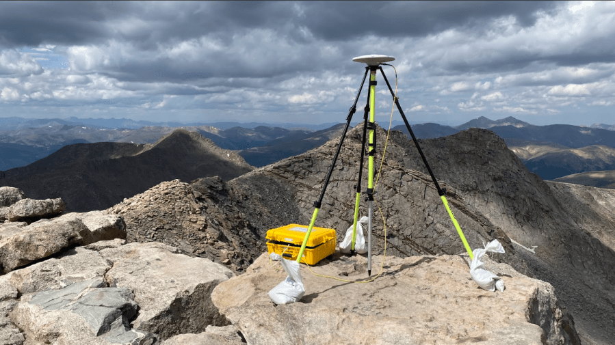
A team of NGS researchers published a study in the Journal of Geodesy with updated estimations for each of the state’s 14,000-foot mountains, along with uncertainties on the new values.
The changes are due to the upcoming use of new national geopotential data as well as a re-analysis of the original heights based on classical geodetic surveying techniques.
Each 14er is still above the 14,000-foot threshold, however, the rankings regarding how high each summit is have done some “shuffling,” according to the NGS. For example, Huron Peak is now the lowest 14er, with a newly estimated elevation of 14,004.1 feet.
The NGS said the elevations that are currently published in the North American Vertical Datum of 1988 (NAVD 88) were found to be about a meter too high.
“To investigate and correct this, the team developed a novel technique to redetermine these heights from the historical triangulation data that was measured in the 1950s,” the release said.
Researchers expected statewide elevations to change to 60 centimeters lower, but the NGS said the researchers “discovered that the summits were actually appearing to decrease by almost another meter.”
Researchers reevaluated the historical triangulation data from the 1950s that was originally used to estimate mountain elevations, and the triangulation-based zenith angles were found to be too high by about 100 centimeters, according to the NGS.
The results of the study highlight the differences in the various geoid models, which was particularly important for the geodesy community, the NGS said.
Going forward, the NGS said the National Spatial Reference System will be modernized and new datums will replace all three North American Datum of 1983, including NAVD 88.
Here are the newly estimated 14er elevations, according to the NGS:
NameEstimated Total Uncertainty (1s): [m]Elevation (NAPGD2022* Orthometric Height): [feet]Mt. Elbert±0.06414437.6Mt. Massive±0.06114423.9Mt. Harvard±0.06214421.7Blanca Peak±0.08014348.5La Plata Peak±0.06814343.0Uncompahgre Peak±0.06514315.8Crestone Peak±0.12114296.8Mt. Lincoln±0.06014290.6Grays Peak±0.06114275.5Castle Peak±0.06514272.3Torreys Peak±0.06114270.1Quandary Peak±0.05814269.9Mt. Antero±0.06714269.0Mt. Blue Sky±0.06814266.1Longs Peak±0.07314255.9Mt. Wilson±0.06614254.1Mt. Cameron±0.06114245.9Mt. Shavano±0.06414228.3Mt. Princeton±0.07714200.1Mt. Belford±0.06514199.6Mt. Yale±0.06314197.0Crestone Needle±0.12514194.8Mt. Bross±0.06014177.9El Diente Peak±0.06414173.2Kit Carson Peak±0.11314165.2Maroon Peak±0.06314161.5Tabeguache Peak±0.06714157.0Mt. Oxford±0.06214156.3Mt. Sneffels±0.07014153.3Mt. Democrat±0.06114152.3Capitol Peak±0.06014136.3Pikes Peak±0.06714107.0Snowmass Mountain±0.06014101.7Windom Peak±0.07014087.0Mt. Eolus±0.07114085.0Challenger Point±0.11314084.6Mt. Columbia±0.06414072.6Missouri Mountain±0.06914069.2Humboldt Peak±0.11814066.6Mt. Bierstadt±0.07214064.5Sunlight Peak±0.07114059.0Handies Peak±0.06914055.9Ellingwood Point±0.08114054.9Culebra Peak±0.06814053.2Mt. Lindsey±0.08314053.2Mt. Sherman±0.06414040.4North Eolus±0.07114039.8Little Bear Peak±0.08914039.5Redcloud Peak±0.09714036.0Conundrum Peak±0.06514034.7Pyramid Peak±0.06714027.1Wilson Peak±0.07514020.4San Luis Peak±0.07114020.2North Maroon Peak±0.06314019.9Wetterhorn Peak±0.06214018.9Mt. of the Holy Cross±0.06014005.2Sunshine Peak±0.07514004.5Huron Peak±0.06314004.1National Geodetic Survey new elevation estimations
The NGS noted that these measurements are preliminary as a final version of NAPGD2022 has yet to be officially defined.

