COLORADO SPRINGS- Strong wind is picking up fire danger through this weekend and it is bringing dust and smoke with it.
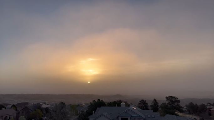
Dust and smoke arrived over the weekend and obstructed views of Pikes Peak turning blue skies into a haze around Southern Colorado on Monday.
Greg Heavener, Warning Coordination Meteorologist at the National Weather in Pueblo said most of the haze and smoke is arriving from the southwest because of a consistent weather pattern.
“Combine that with even some of the dust and sand from the Great Sand Dunes over in the San Luis Valley, making it across the Sangre De Cristo mountain range again onto the Front Range. So the combination, but the primary source is dust, sand and even wildfires in Northern New Mexico right now,” Heavener said.
A slow-moving low pressure system over the Pacific Northwest has caused the jet stream to be centered over Colorado, producing strong wind and high fire danger days as a result.
Strong jet stream overhead of Colorado
Heavener said we typically will see the jet stream migrate this time of the year, but lately the set-up has been stagnant causing more extreme fire danger days.
“We’ve had more of those days in the past four weeks than we have had combined in the last 15 or 20 years across the area,” Heavener said. “The fact we are still having these intrusions of these really strong jet stream winds. Again this is not a typical April as we saw even into early May this is not a typical climate regime we’re used to.”
Until consistent moisture returns, fire danger and extreme fire danger days will continue.
“We are going to be stuck unfortunately with the daily threat impact of having explosive wildfire conditions across the region so until we see anything substantial, that threat is going to persist unfortunately. So don’t let your guard down, everyday we’re drying out more and more than the previous day and it just adds to the potential explosiveness of wildfires across the area,” Heavener said.
Over the next few days the jet stream wont move much which means more windy and dry conditions. Red Flag Warnings are likely to continue through this week as fire danger remains high and Thursday could bring another extreme high fire danger day.
At this point, we don’t see any major rain or snow makers on the horizon. But stay with the FOX21 Storm Team for updates.

