(ARIZONA) — A dramatic dust storm, known as a haboob, swept through Arizona earlier this week, capturing attention both on the ground and across social media. Photos and time-lapse footage from Arizona State University’s football stadium show a massive wall of dust quickly overtaking the field. (Time-lapse shown in video player above).
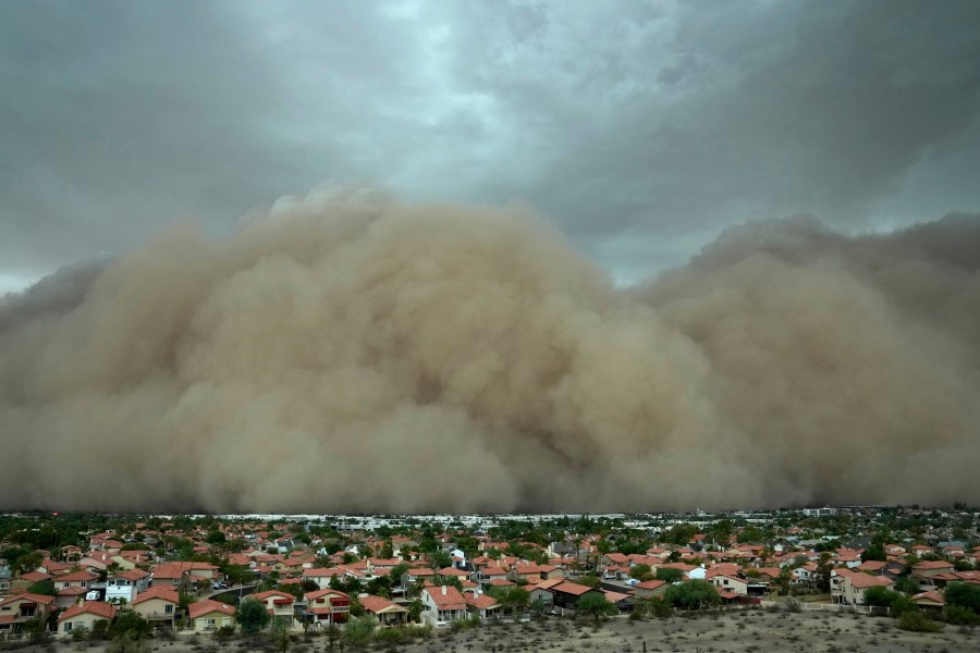
Drone footage shared by Jamie Dyer highlighted the scale of the event. The video shows a towering wall of dust advancing rapidly, reducing visibility to near zero very rapidly.
So how do haboobs form? In a gist, they occur when a thunderstorm produces a strong downdraft, which is a powerful rush of air directed toward the ground. When this air hits the surface in a dry, desert environment, it behaves like a mini cold front. The force lifts dust and dirt into the air and pushes it outward, creating the massive rolling wall of dust seen in the footage above.
This photo provided by the City of Phoenix shows a towering cloud of dust at Phoenix Sky Harbor International Airport on Monday, Aug. 25, 2025. (City of Phoenix via AP)
The phenomenon is not just dramatic, but also dangerous. Sudden drops in visibility can pose serious risks to drivers caught on the road. In some cases, the uplift of cool air from the downdraft can even help fuel nearby storms.
Images of the Arizona haboob circulated widely online, including striking shots shared by aviation enthusiasts on Twitter. The storm served as a reminder of how quickly and powerfully nature can transform, especially within the desert landscape.

