COLORADO SPRINGS — High winds are expected Monday night into Tuesday, with Red Flag Warnings and fire restrictions in effect across the Front Range. But how does this storm measure up to the winds that took down trees and power lines and toppled semi trucks on December 15th?
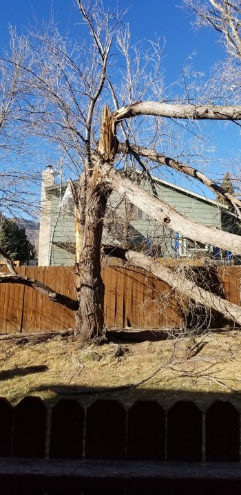
Overturned semi-truck on Fillmore NB off rampSemi-truck overturnedOverturned semi-truck on I-25 and FilmoreTree damage and overturned semi trucks on December 15, 2021
Fox21’s meteorologist Robert Hahn predicts the winds will be very strong for most of southern Colorado, but not quite as high as the December 15th storm, with the only exception being the Huerfano county area where gusts could be as high as 100 m.p.h. “This will likely cause a significant amount of blowing dust that could reduce visibility to well under a mile at times. This blowing dust could impact many roads in southern Colorado, mainly south of Pueblo, including I-25. Elsewhere, wind gusts will reach up to 70 m.p.h. which could also loft dust into the air, occasionally reducing visibility, particularly in open areas.”
Aside from visibility and blowing dust, the winds pose a severe danger for fires.
“Winds like the ones we’ll see Monday night into Tuesday have the potential to cause some minor tree and power line damage, so some power outages are possible,” said Hahn. “The bigger concern, however, would be if any fires break out. With the very strong winds in the forecast, any fire would grow and spread at an incredible rate. A Red Flag Warning is in effect for most of the area Tuesday for that danger.”
High winds like the ones forecasted for Tuesday can easily spread a small spark quickly, as seen with the deadly and devastating Marshall Fire in Boulder county. Meteorologists are urging everyone to avoid any activities that could potentially spark a fire.
You can read Matt Meister’s predictions for the upcoming wind storm here, and keep up to date with conditions at fox21news.com/weather

