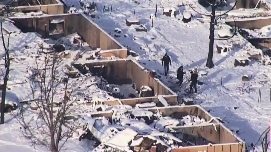
BOULDER COUNTY, Colo. (KDVR) — The Boulder County Sheriff’s Office reported a total of 991 structures were destroyed in the Marshall Fire throughout Superior, Louisville and unincorporated Boulder County. A preliminary list of homes and businesses was released Saturday afternoon.
An additional 127 structures were damaged in the blaze that covered over 6,000 acres. Residents have been allowed to go back to their homes in some areas, while other parts remain evacuated.
The fire is the most destructive in Colorado history, but no deaths have been reported from the disaster. The sheriff’s office did confirm three people missing in a news conference on Saturday.
FOX31 has taken the data provided by the sheriff’s office and created the searchable list and interactive map included below in this story.
Preliminary totals
Sheriff’s investigators and damage assessment teams are working to identify all the homes and businesses damaged by the fire. The list released Saturday afternoon is expected to grow as teams inspect more of the area.
Updated lists will be released by the Boulder Office of Emergency Management and the City of Louisville. Any structures which should be added to the list can be reported to Boulder County.
As of 1 p.m. Saturday, the following totals have been released:
Louisville: 553 destroyed, 45 damaged
Superior: 332 destroyed, 60 damaged
Unincorporated Boulder County: 106 destroyed, 22 damaged
Searchable list of addresses
This preliminary list provided by the sheriff’s office is current as of 1 p.m. Saturday. It should be considered partial and incomplete. The list will likely change as damage assessments continue and teams get a closer look at the area over the next week, as all assessments are done visually.
Map of structures damaged and destroyed
This map includes the addresses from the preliminary list above, provided by the sheriff’s office and is current as of 1 p.m. Saturday. As with the list above, it should be considered partial and incomplete and the list will likely change as damage assessments continue and teams get a closer look at the area over the next week, as all assessments are done visually.
Points on this map were plotted automatically using Google Maps, from the addresses on the list provided by the sheriff’s office. While every effort was made to ensure accuracy, the locations are based on where Google Maps believed the address to be, and it is possible some of the points are not placed on the exact location of the structure. Also, if an exact address was not available (such as when a neighborhood or subdivision was listed) the structure was not included on the map.
FOX31 will work to update the list and map with updated addresses as they are released by officials. Boulder OEM will be the official source of all information.

