What poor timing for all of the outdoor events we love on Independence Day. The arrival of a cold front during the day brings the ingredients for severe thunderstorms across a large portion of southern Colorado on Tuesday.
Areas along and north of the Arkansas River are more likely to see a severe thunderstorm on Tuesday than areas farther south, but even in those areas over the southern foothills and Raton Mesa a severe storm can’t be ruled out.
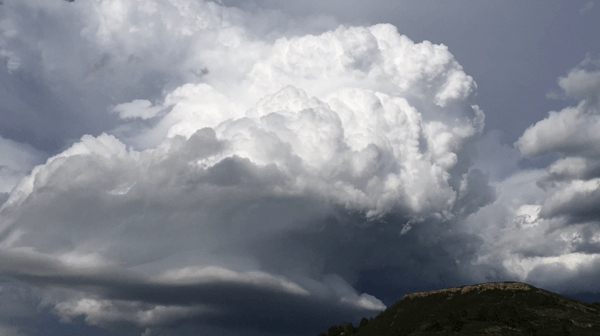
The wonderful Tri-Lakes Fourth of July festivities in Palmer Lake and Monument are highly likely to get a thunderstorm moving overhead in the early afternoon. The storm is expected to be strong and may have some large hail greater than an inch in diameter as it moves to the ESE across the region. This is most likely between 12:30pm and 3pm. Additional storms may redevelop in the late afternoon or early evening in the Pikes Peak Region and these storms would likely stay below severe levels. Areas farther south will have a chance of storms in the later part of the afternoon and evening, so the famed wet parade in Pueblo West should go off with out a hitch in the late morning.
As the early afternoon storm moves to the ESE over the plains it will likely grow and cluster with other storms, gradually dropping the threat for large hail, but increasing the threat for strong and damaging straight-line wind. I’ll break it down this way: between noon and 4pm from the mountains east to highway 71 (north of the river) – large hail will be the most significant severe weather threat. South of the river and east of highway 71 straight-line wind is our greatest severe weather risk on the fourth.
If you click through the slideshow above, you’ll see that we are hopeful that storms scoot east in time for fireworks for many areas. KEEP YOUR FINGERS CROSSED that this works out!

