(EL PASO COUNTY, Colo.) — Hail as large as 1.75 inches in diameter fell on El Paso County on Sunday, June 16, and FOX21 News viewers sent pictures of the impressive ice chunks that fell in their area. There were no reports of tornadoes from the storm on Sunday.
Viewer, Jeremy A., sent a photo of hail he described as being the size of a half dollar that fell near Galley and Academy, near the Citadel Mall.
Katharine E. sent pictures of hail gathered after the storm in the area of Mountain Shadows.
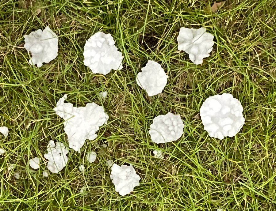
Carol H. sent photos of interestingly shaped hail from around the Constitution and Union area that she said were made up of smaller pieces fused together.
One viewer sent a photo of a piece of hail large enough to fill the center of a teacup plate.
Viewer Anjelah W. sent the photo below of the storm clouds that were forming around 6 p.m. on Sunday, around I-25 and Circle. According to FOX21 Storm Team Meteorologist Megan Montero, the image shows a mesocyclone forming. A mesocyclone is a rotating updraft that can be the precursor to a tornado, according to the National Oceanic and Atmospheric Administration (NOAA), no tornado was detected during the storm.
According to the National Weather Service, Southwest Falcon, Northwest Colorado Springs, and Black Forest all averaged around .5 inches in diameter. Monument had hail measuring around an inch in diameter. The largest recorded hail fell near Peterson Air Force Base, with diameters ranging from .75 to 1.75 inches.

