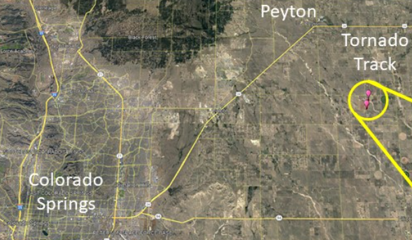
(EL PASO COUNTY, Colo.) — The National Weather Service of Pueblo (NWS Pueblo) said it has tracked where a tornado apparently touched down in northeastern El Paso County on Thursday, June 22.
According to NWS Pueblo, it happened south of Peyton and was estimated to be an EF-0 tornado, based on video footage, photos, and storm spotter reports received by NWS Pueblo.
NWS Pueblo released a photo on Thursday of the estimated track of the tornado:
NWS Pueblo estimates track of a tornado in NE El Paso County on June 22, 2023.
According to the NWS, the Enhanced Fujita Scale classifies tornadoes into the following categories:
EF0…Weak……65 to 85 mph
EF1…Weak……86 to 110 mph
EF2…Strong….111 to 135 mph
EF3…Strong….136 to 165 mph
EF4…Violent…166 to 200 mph
EF5…Violent…>200 mph
On Thursday, a tornado also touched down in Highlands Ranch and was estimated to be an EF-1 tornado, according to the preliminary assessment by the NWS.
The Douglas County Sheriff’s Office (DC Sheriff) shared photos and videos of the damage, which happened across Highlands Ranch and Parker.

