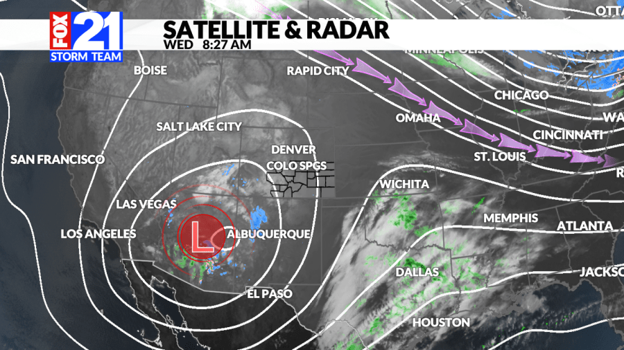
(SOUTHERN COLORADO) — The next system is quickly approaching from the desert Southwest. A large “cut-off” low is swirling nearby leading to some lingering questions on what the forecast may look like. “Cut-off” lows can be tricky as they are generally “cut off” from the main flow of the atmosphere. This means that those systems can be a bit of a wild card.
Here’s what we know:
Snow timing: Wednesday evening on into Thursday late morning
Amounts: Higher up over the Palmer Divide, portions of the Pikes Peak Region, and higher elevations
Impacts: Thursday morning commute may be particularly tricky
Some models are indicating we may start to see some light snow develop as early as dinnertime on Wednesday. However, more consistant snowfall is expected after midnight.
During the overnight hours light snowfall will begin to filter into the area. Terrain will play a large role in where higher amounts of snow may pile up, but there’s a bigger factor that the FOX21 Storm Team is on the lookout for: a deformation snow-band. More on that below.
Right around sunrise on Thursday, heavier snowfall will likely be moving through the Pikes Peak Region. This could prove tricky for the commute so be sure to give yourself a little extra time out the door.
The other big snow factor that the team is watching for is something called a deformation snow-band. These narrow bands of snow typically form on the backside of a low-pressure system. They can produce significant amounts of snow quickly and are notoriously difficult to forecast for because they can set up almost anywhere.
Here are some tentative numbers for what snowfall amounts may look like. The larger amounts displayed over the Palmer Divide and through the Denver Metro may shift. Those higher numbers are in an effort to pinpoint where those heavy bands of snow may set up.
These numbers will likely change again before the snow really picks up this evening so be sure to check back in with the FOX21 Storm Team for the most up to date information.

